From February 2014 Floodplain Management Today
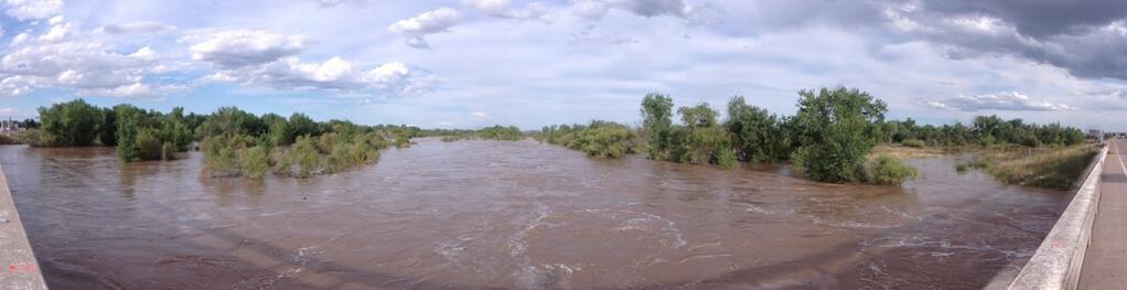
After the significant rainfall in mid-September 2013 in the mountains near Boulder and Denver in Colorado, an unprecedented surge of floodwater came downstream to Nebraska. There was concern that the floodwaters could inundate areas along the South Platte and Platte Rivers in Nebraska. Streamgages in Colorado were destroyed by the flooding, so the amount of floodwater that would enter Nebraska was uncertain. NDNR sent streamgaging crews to measure flows in western Nebraska and obtained data from existing streamgages operated by USGS. The anticipated flood flow data was used by NDNR to map potential inundation areas. NDNR then provided the information to the Nebraska Emergency Management Agency and local governments to assist in the flood response.
NDNR monitored flows as the floodwater continued to move downstream. Record crests in the flow in the South Platte River were recorded near Roscoe (12.2 feet) and North Platte (14.4 feet), and in the Platte River at Maxwell (10.83 feet) and Brady (9.8 feet). As the floodwater moved into Nebraska from Colorado, the flow was approximately 22,000 cubic feet per second.
Before:
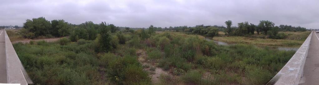
After: