By Mitch Paine, CFM
From September 2015 Floodplain Management Today
In early 2013, NDNR and the US Army Corps of Engineers (USACE) approached the Village of Cedar Creek and the City of Louisville about digging deeper into flood risk information for properties in their communities. Both towns in Cass County were extremely interested and so set off the 2 year Cass County Mitigation project that yielded tremendous results for all partners.
Cedar Creek and Louisville wanted to build upon previous flood mitigation conducted in 2006. Those plans included individual structure elevations, but were based on LiDAR estimates, not field surveys. While the prior plans offered a lot of data and mitigation alternatives, the communities wanted enhanced surveys and property-level analysis along with more public participation, and NDNR and USACE were interested in this effort too. The Cass County project was part of an ongoing effort, called the Nebraska Silver Jackets partnership, by state and federal agencies to collaborate on flood-related projects.
The goal of the project was to encourage mitigation actions with the best and most up-to-date flood risk information.
The largest effort in the project was the data collection phase. Surveyors from NDNR worked in Cedar Creek and surveyors from USACE worked in Louisville. At each structure, the surveyors shot the elevation of the observed first floor. Because they did not have access to go inside homes, they did not measure the elevation of the basement floor. Over 500 structures were examined throughout both communities.
After collecting elevation information for the structures in the communities, the data was compared to Cass County Assessor data and other building characteristics. Then, all of the building data was put into the context of flood risk and buildings were compared against multiple floodplains (10-year, 25-year, 100-year, etc.). Flood elevations were calculated for each building, and based upon average damage costs, an expected annual damage estimate was given. Expected annual damage gives us a way to think about how often a building may get flooded and the average extent and cost of the damage while forcing us to think of those total costs split up year by year.
Using the data collected for each structure, USACE was able to figure out which properties were most at risk and determine appropriate mitigation alternatives for each structure. Both communities stressed doing outreach and meeting with property owners as part of the project, so the agencies sought to make the data useful to homeowners and business owners. Maps were created, flood information by address was assembled, and flood insurance scenarios were developed, all to help the average homeowner understand how they could reduce risk for their property.
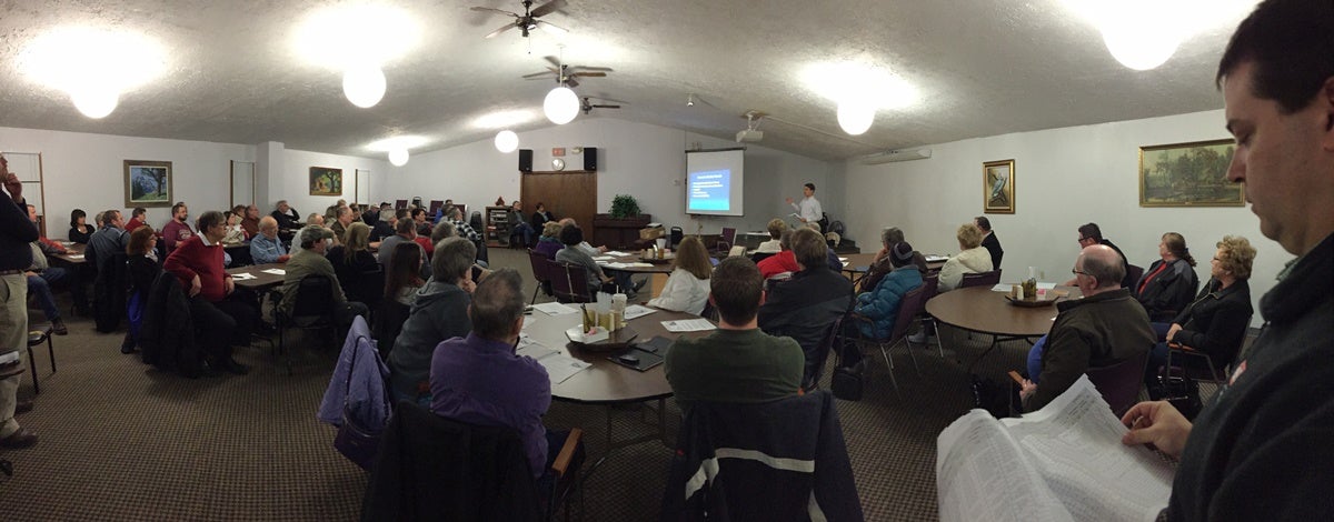
The public was invited to attend an open house in Louisville on February 24th, 2015 to learn more about the data collected and mitigation actions they can take. Over 75 community members attended, many of whom were from Cedar Creek and were concerned with flood insurance rates. Randy Behm and Tony Krause from USACE, Shandi Teltschik from FEMA, and Mitch Paine from NDNR presented at the open house. The presentations consisted of an overview of home mitigation and floodproofing techniques, an overview of flood insurance changes, specific mitigation scenarios and benefits, and how homeowners can start their own risk reduction projects.
The message that NDNR, USACE, and FEMA were trying to get across is that while home elevation projects, for example, are expensive, they can drastically reduce the amount a homeowner pays in flood insurance and actually improve the value of their building. Elevation also provides an effective way to reduce a family’s risk from flooding.
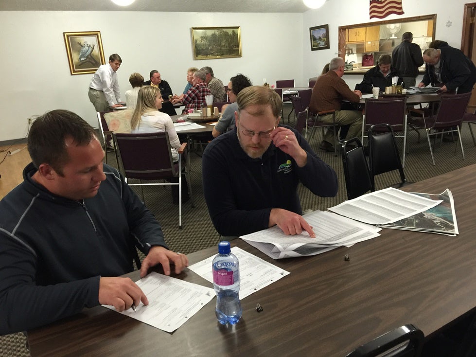
After the presentations, various staff from USACE, NDNR, and FEMA sat with residents to help them understand their own property conditions. The one-on-one conversations helped bring the complex world of floodplain management and flood insurance down to an understandable level. Most of the audience members stayed to discuss their own property with the agency representatives. They left with a much better understanding of their property risk and their options to reduce it. The feedback showed that residents found the project incredibly helpful and useful.
While the open house was a very successful event, Dee Arias and Chuck Paukert, CFM, the floodplain administrators for Louisville and Cedar Creek, respectively, have taken all of the information about properties and used it to enhance their own outreach to citizens. When people call their offices to inquire about properties, they now have a wealth of information to give to their callers. With all of the additional flood risk data, better decisions can be made about improving buildings, home sales, buying flood insurance, building on adjacent lots, and doing mitigation projects to reduce flood risk.
In the coming years, hopefully this work will inspire flood mitigation projects like community-led buyouts and individual home elevations. Already, some homeowners have expressed a serious interest in elevating their home. NDNR and USACE hope to find financial resources to help both Cedar Creek and Louisville continue to reduce their flood risk and make their communities even better places to live.
If your community is interested in doing a similar project, contact Katie Ringland at Katie.Ringland@nebraska.gov or 402-471-2094.
For more information about the Nebraska Silver Jackets program, visit the website: https://floods.nebraska.gov/